Introducing the new Illustrated Map of Todmorden
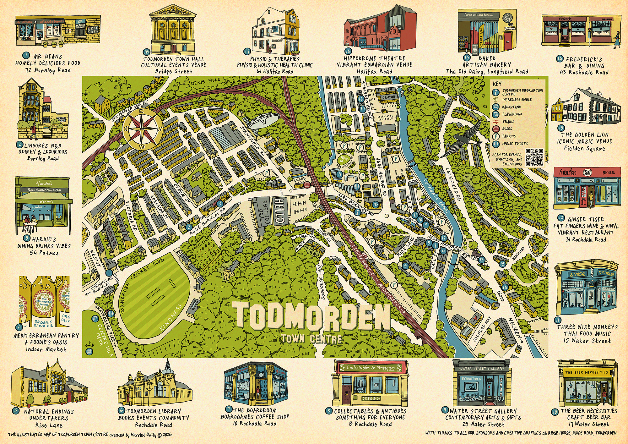
I’m very excited to introduce the brand new illustrated map of Todmorden town centre, published early last week!
This has been a dream project from beginning to end. I’ve worked with 18 wonderful sponsors, whose venues are illustrated around the edge of the map and correspond by number to their locations within the town centre.
The map was drawn by hand, using good old-fashioned pens and paper, before being coloured digitally. I wanted to create something that was not only useful, but also captured a little of the character and individuality of Todmorden; its buildings, its landscape and all the small details that make the town what it is.
The map has been designed to be genuinely useful, particularly for first-time visitors to Todmorden. Perhaps you want to start the day with a cup of coffee, have a wander around the shops, explore some of the town’s wonderful buildings and attractions, and finish with an evening meal before heading home. The map will help you find your way around, as well as showing all the practical things you need to know, including trains, buses and places to park.
On the back, you’ll also find a warm welcome from our very own Todmorden Information Centre, along with more useful information to help you explore the town.
In a few weeks’ time, you’ll start to see the maps appearing in venues and locations around Todmorden. They’re completely free, so pick one up, have a wander and discover what our wonderful little town has to offer. ❤️